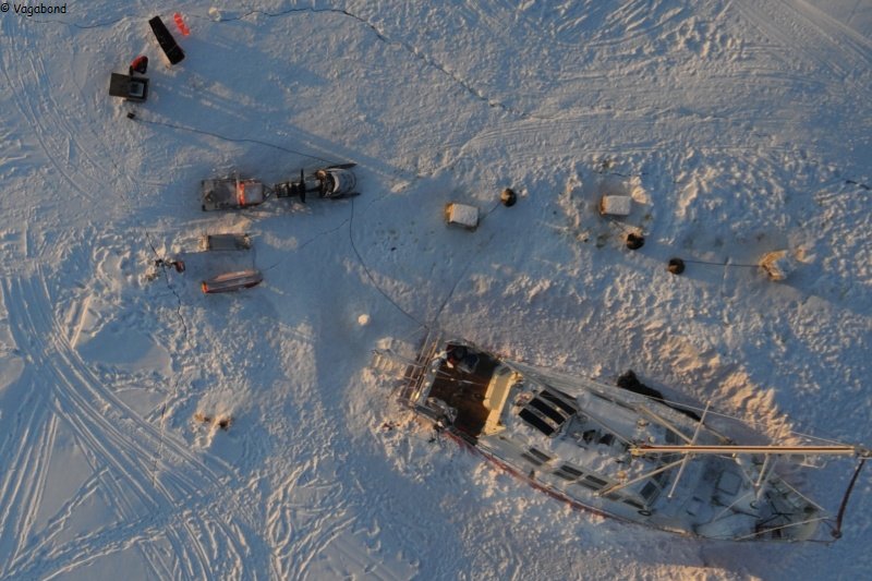
Bathysonde
Every 2 days, except if a storm is keeping us inside the boat, we are using the CTD instrument in Inglefield Bay to measure the salinity and the temperature of the sea water depending on depth. We are doing better and better, and each trip looks like a small expedition! First we have to load all the equipment in the sledge, without forgetting the 'safety' case and the gun, to harness the dogs, and then one is breaking the trail in the light of his cap lamp, while the other is pulling the sledge helped by the dogs. Depending on weather conditions, we are going more or less towards the middle of the bay. At chosen location, we then have to shovel up the snow from the ice pack, drill a hole with the ice hand drill, set up the stand with the winch, get down the weight only to check the depth, finally plunge the CTD going up and down twice to guarantee good results. We must not waste any time till this point because the CTD would freeze and would not record anything! Then, a 'homemade' height gauge allows us to know the sea ice thickness (1m today), and the GPS records the precise position of the hydrological survey. The trip back is always quicker, the dogs know very well where are their food...