Out of the ice
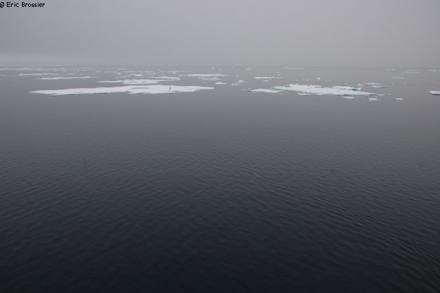
The Fram Bay is a protective trap, Vagabond could spend the winter there... The ice pack is drifting through Rice Strait since yesterday (September 1st) and we decide to try to follow it, heading south. Right out of the bay we are carried on a kind of conveyor belt which carries aggressive floes, thick, with little room for sailing. Not to mention the little headwind pushing Vagabond on an edge of the narrow strait. When movements are decreasing, it is because the channel is filled up, the ice is embedded in a giant puzzle. A too high floe just stamp the back of Vagabond already locked, bending the cable holding the mast under the rear platform... Fortunately, it simply deforms under pressure.
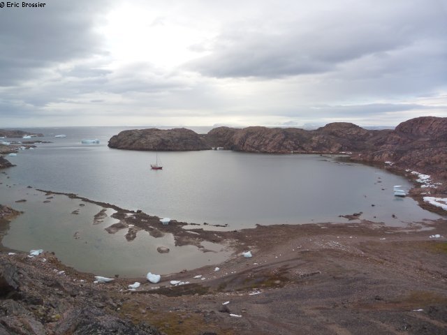
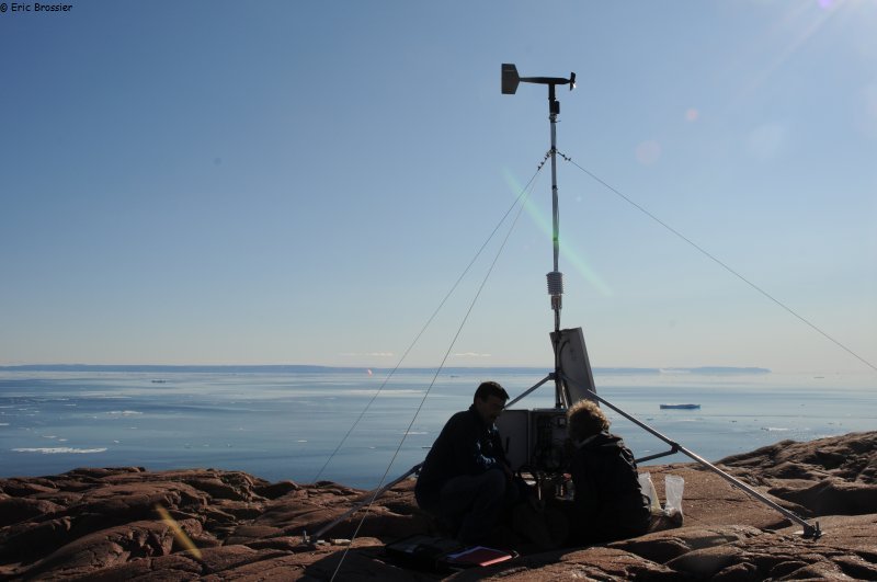
We struggle to avoid over exposing the hull, and less than one nautical mile is covered in half a day! After an hour of respite, to our surprise, the current is reversed, this time we try to go back to the north. Quickly reaching the exit of the channel, we finally discover a channel of open water along Pim Island, we are out of the trap! We are passing Clay camp, but there is too much snow to watch. In addition, a large barrier of dense pack still separates us from the open water towards Greenland. We are at the narrowest point of Smith Sound and we can see it, pink in the setting sun, 20 nautical miles away, far less snowy than Canada. Scientists, who are sending us ice charts and satellite images, are announcing winter conditions one week earlier than usual. In the North West Passage, some sailboats surrendered. Further north, Babouchka's crew has just been recovered by a Russian icebreaker. In Kane Basin, north of Smith Sound, new ice is already forming. After an unsuccessful attempt, we moor Vagabond to an ice floe, near Brevoort Island, where it is impossible to land: we were hoping to inspect, even repair the weather station, recently destroyed by a polar bear, presumably. While drifting, Eric manages to make a final measure with the CTD (finishing the Smith Sound section). At 11pm, enjoying the calm before the announced wind, Emmanuel returns to the pole, Eric at the helm, while France is back in the crow's nest to guide Vagabond through the maze of ice. At four o'clock in the morning she goes down, less ice. At 6am, in the first gusts of wind, Vagabond anchored in the good shelter of Cache Point, a beautiful small and steep bay. Only Aurore, Léonie and Eric are going ashore, always eager for discoveries: remains of Inuit settlements (rings of stones), hut remains, cairns and inscriptions left in the lichen by rare sailors and hunters.
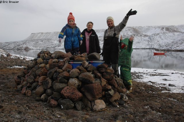
On September 5, after a good rest, we decide to go explore a little further north, Inglefield Land, definitively leaving aside the initial project of setting foot on Hans Island, too far north and submerged in ice (last ice map is impressive!). Along the way we are approaching another ice island (PII2012A1d), smaller than the first but steeper. Majestic ice cliff that Vagabond is sailing along then around, before continuing in a heavier and heavier fog. Emmanuel takes advantage of better weather for a film session, walking alone and bewildered, on an ice floe... The maps become shifted, badly drawn, completely wrong! Tonight, to enter Inuarfigssuaq Bay, 78°31'North (Marshall Bay), only the radar can help us in blowing snow and persistent fog. South wind got up again, it's not until morning that we discover our shelter, which a large portion is dry: at low tide, there is no more than a meter of water under the hull! Finally, the sun is back. It is here, at the northern most of our journey (toast!), that we lay the food and fuel depot for Alex Hibbert (Dark Ice Project). After unloading by dinghy, we need more than three hours to bury somehow under stones 8 drums and 11 bags, to protect them from curious and voracious bears.
Meanwhile, Catherine and Emmanuel are taking pictures of each of their 193 flags, in this high latitude pristine landscape. The place is beautiful ... Hills and mountains offer several point of view on the ocean, three freshwater lakes nearby, maybe well stocked with fish, an ideal place for winter! Cans of fuel indicate that the site can be used by aircraft for landing.