Fury and Hecla
Beautiful day, glassy sea and whales when crossing the Gulf of Boothia. The crew is lucky! Alicia and France can sort out the coralline samples, while the girls are playing on the front deck.
It's getting dark when Vagabond reaches Baffin Island again, threading her way through drifting ice. First ice floes since we left Qikiqtarjuaq, end of July! Magical night watch. A shooting star, very bright, green, is showing me the way. Radar, sonar, and search light are helping me to find a safe anchorage, in 4 meters deep water, waiting for the sun to rise to sail again.
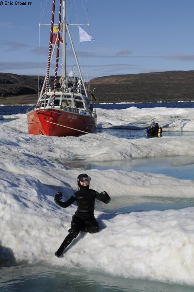
Ice charts are clear: mainly open water, only the next 50 miles will have drifting ice. Early in the afternoon, despite the wind picking up, we choose a big ice floe to moor to. France is guiding me from the crow's nest, then she takes over steering to keep the bow against the ice, while I set up an ice-piton and tighten the rope. We are right at the entrance of Fury and Hecla Strait and we are drifting at one knot to the East with the current, in the right direction!
Aurore already slipped on her wet suit. Here she is paddling in the melt ponds, where France and Alicia are collecting fresh water. Celine and Yves are diving to explore our ice floe. Leonie is also very excited to run, jump and dive. Then time to take pictures and videos for our partners. We were all missing ice!
After all, we spend the short night moored to the ice floe. At 3 am, we enter the long strait (80 nautical miles). Goodbye pack ice, three cheers for the good wind and current, our speed reaches more than 9 knots at times. whether the tide is coming in or going out, it seems that the current remains favourable. Electronic charts are not yet existing for this region, neither for the entire Foxe Basin. So we are using a copy of the paper chart given by the captain of the Amundsen, on which is drawn the route of the ice-breaker. Even if there is no sounding, the land charts are quite precise and useful too. As well as the satellite pictures we downloaded before from GoogleEarth. At the narrowest (Labrador Narrows), the strait is still about 2km wide. Quickly and without a hitch, we enter Foxe Basin.
Getting to Igloolik is more tiring. Yves tries to find a pass between shallows from the crow's nest, being shaken a lot. Usually, we can see much better the seabed from the top of the mast than from the wheelhouse. In vain, we have to go back and sail all around a little island before entering the nicely protected bay of this large Nunavut community.
According to the sailing instructions, "it is not possible for other boats than icebreakers to try to go through Fury and Hecla Strait". This year with no ice is exceptional. We learn that our friend David Cowper, on board Polar Bound, went through last week, going West. Vagabond might be the first sailboat to go through the Strait. A cruise ship is suppose to pass in two days. Our friends on board the sailboat Pachamama are planning to go through in a few days.
So now, it seems that sailing in this region is difficult due to the lack of sea charts, not any more because of drifting ice. For the local hunters and their small boats, less ice means more waves, which is much more dangerous.