Geophysical survey on top of Devon Ice Cap
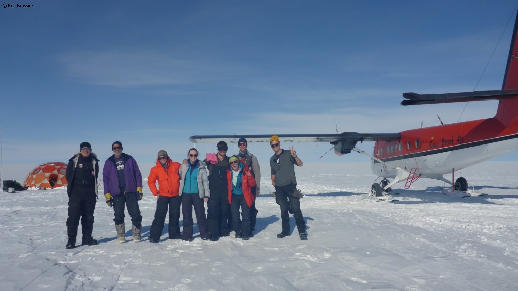
Back from 27 incredible days of field work on top of Devon Ice Cap, at 1800m altitude. With a great team of 4 people, carrying over 3 tons of equipment, we looked for subglacial lakes!
Airborne radar surveys flown in 2016 and 2018 gave evidence for the existence of a hypersaline subglacial lake complex beneath the center of Devon Ice Cap, Canadian Arctic, where the ice is 760 m thick and the estimated basal ice temperature is -14.5°C. Read more: Radar sounding survey over Devon Ice Cap indicates the potential for a diverse hypersaline subglacial hydrological environment
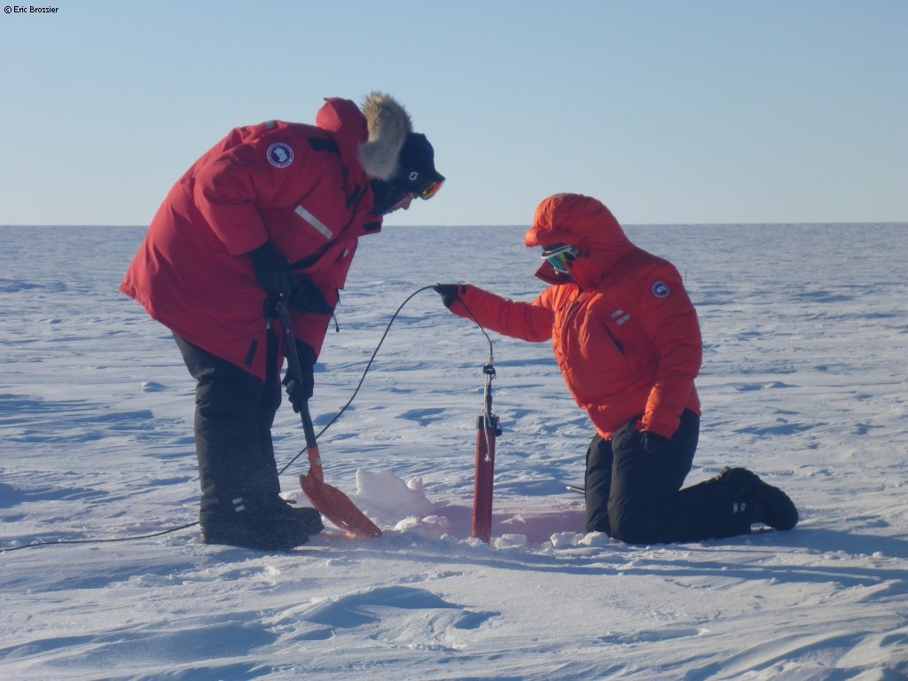
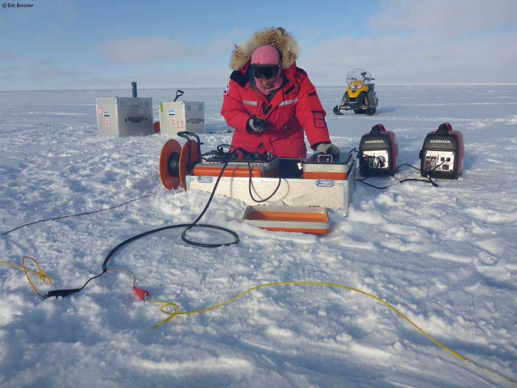
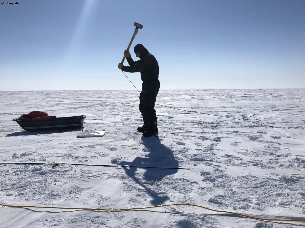
To confirm the airborne surveys and determine the thickness of the water layer, we did a detailed ground-based geophysical survey on Devon Ice Cap. The data acquired included: 9 km of seismic reflection data, 17 magnetotelluric (MT) stations, and 7 large loop transient electromagnetic (TEM) soundings that used a 500 x 500 m loop. Twice more data than expected!
This research is part of the SEARCH-Arctic project funded by the Weston Family Foundation. Thanks to the Polar Continental Shelf Program for logistical support, in particular Dom, Pierre, Tim and Glenn. Field team members: James Killingbeck, Eric Brossier, Brittany Main and Tim Hill. Team members involved with this project, not on the ice cap: Siobhan Killingbeck, Martyn Unsworth, Chritine Dow, Alison Criscitiello, Ashley Dubnick, Anja Rutishauser and Zoe Vestrum.
Brittany and I also went down to Belcher glacier (and almost into crevasses!) to service 2 glacier velocity trackers. These devices were set up in the summer of 2021 by Luke Copland and his Laboratory for Cryospheric Research to better understand how glacier motion is evolving in a warming climate.